
 Zoom to fit the screen
Route history
Submitted by rd on Fri, 12/02/2022 - 14:371. Purpose
- Supports users to view detailed vehicle journeys and simulate vehicle movement every 30 seconds.
2. Implementation conditions
- The user is authorized to use the Route history function in the authorization section.
3. Implementation instructions
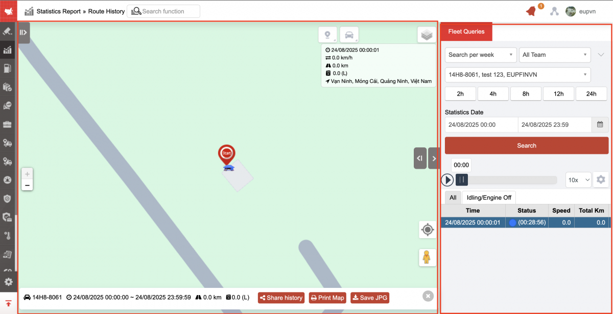
- Go to menu Statistics report/Route history
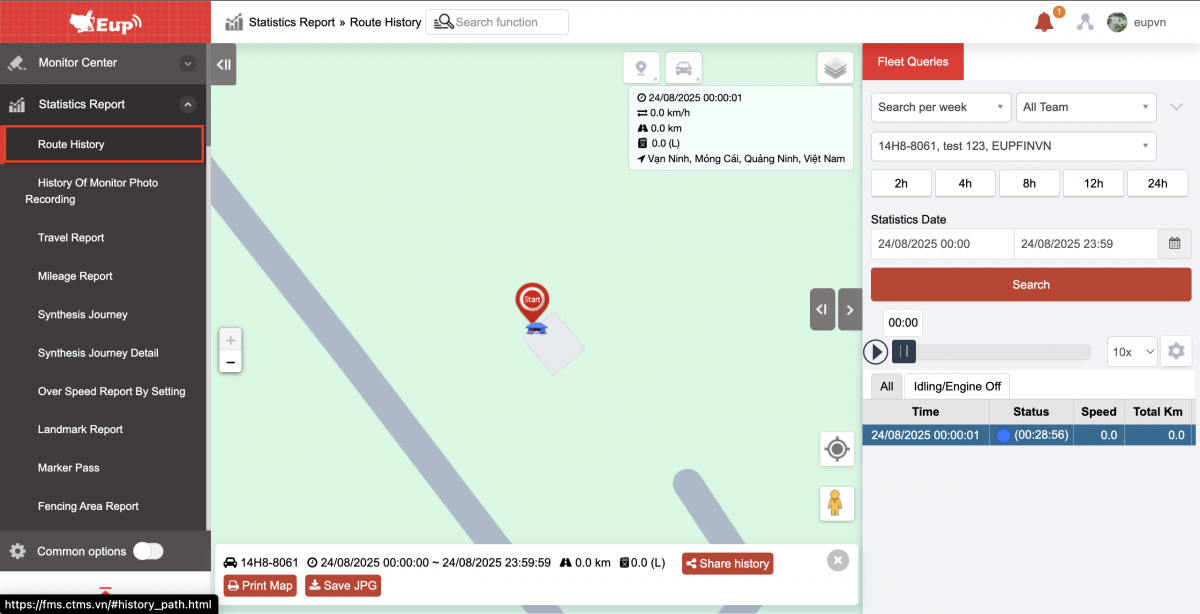
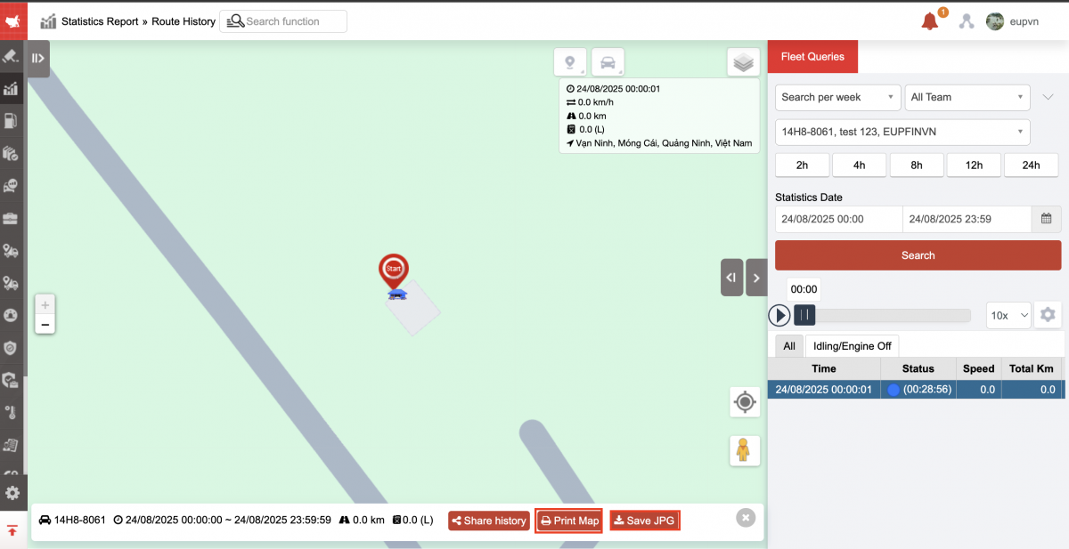
- The function display screen consists of 2 parts:
+ The Map section describes the vehicle's journey on the map;
+ The Fleet Queries section allows users to search and view the journey of each vehicle in the fleet within a certain period of time.
+ Map Section:
-
On the map, the vehicle status is displayed according to the color of the vehicle at each time. This section describes the vehicle's journey on the map. Users can select the play icon
 in the playback speed section to see the vehicle's movement simulation.
 -
Users can click the icon
 to view vehicle information on the map.
 -
The map supports measuring distances between points on the route the vehicle has taken. To measure the distance between points, the user does the following:
-
Step 1: Select the icon

-
Step 2: Select the icon

-
Step 3: Left-click to select each point on the map to measure the distance
-
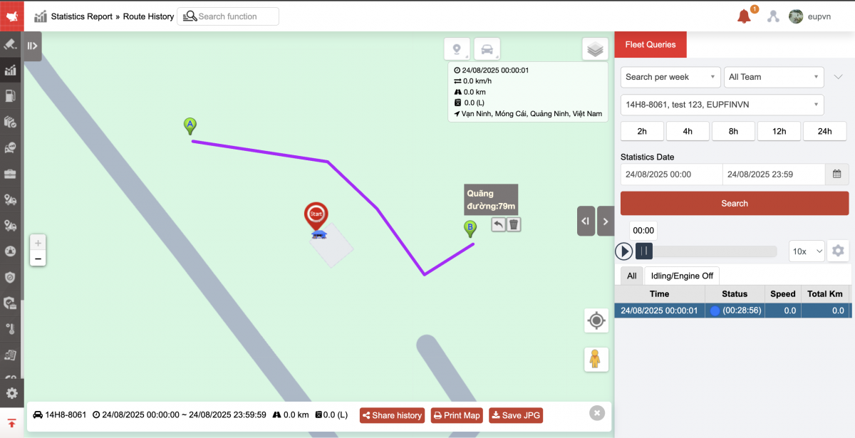
-
Select the icon
then select Print map: Print/ Save as image -
Select the icon
then select Show stations on map in trip history
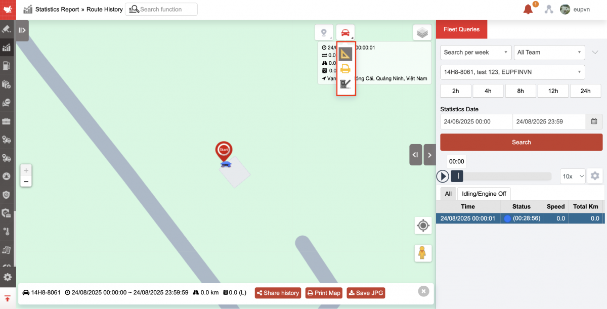
-
Share history: Copy link and send to customer
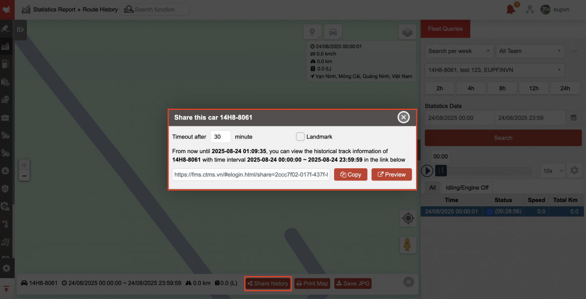
-
Print map
-
Save as JPG
-
Click the icon below to select map type: default map, open street map, satellite map

+ Fleet Queries section includes information:
-
All team: User selects icon
 to change fleet
 -
Select an option (Plate number): Select the icon
to select the vehicle whose travel history you want to view. -
From: Select the first hour, minute, day you want to search
-
To: Select the last hour, minute, day you want to search
-
Click Search to display detailed trip results
-
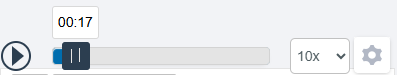
Vehicle movement simulation: User can select the play icon
 to view the vehicle movement simulation on the map. The system allows user to adjust the speed of vehicle movement on the chart.
-
Auto replay: Select the checkbox to automatically playback the vehicle's travel path.
-
Compressed status: Select the checkbox to display detailed trip history by vehicle status
-
Show time at stop point
-
Stop at the stop points
-
Display Info: Enable/disable vehicle information popup in the upper right corner of the map and also when printing/downloading map images
-
Line Pattern: There are two options to draw the vehicle's path in odd lines, in arrows, draw a route or pin the route
-
Draw route: The route will be drawn again as the route is sent.
-
Route Pin: Route Time Pin
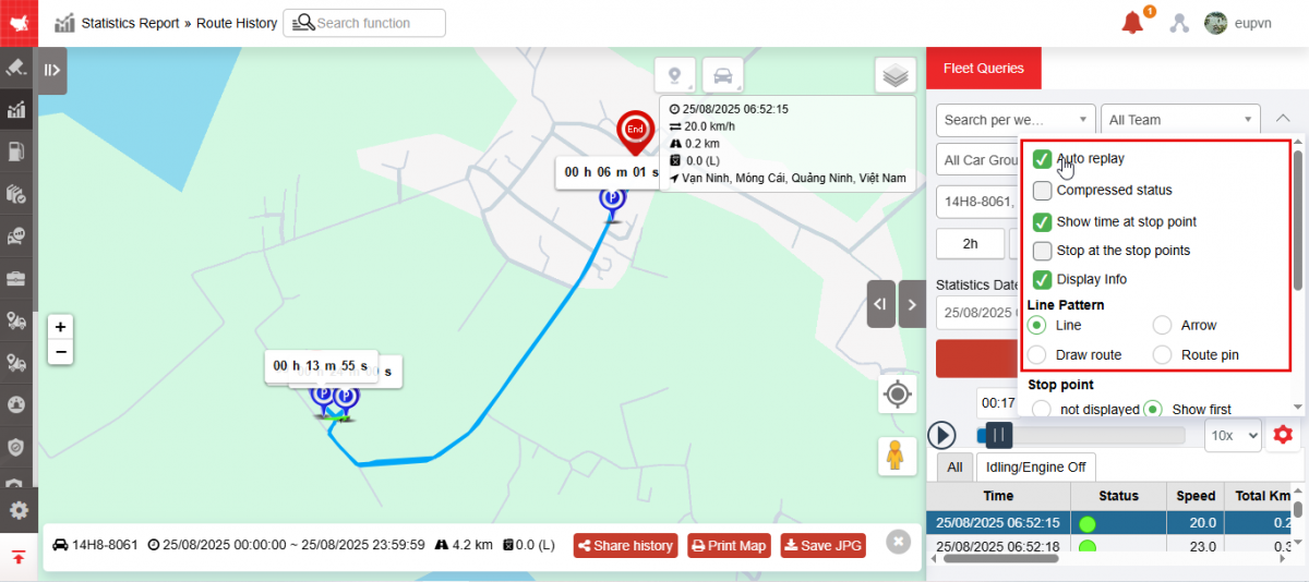
-
-
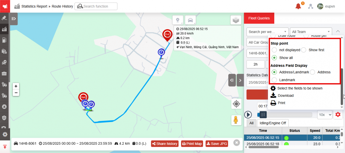
Stop point:
-
Not displayed: No parking stop shown
-
Starting point: If 2 stops are close together, only the first point on the route is displayed
-
All: Shows all stops on the route drawing
-
-
Show address field:
-
Address / Landmark
-
Address
-
-
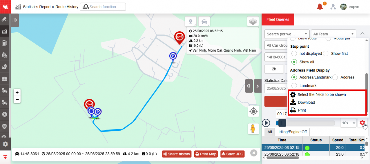
Select fields to display: Customize display columns
-
Download: Excel format
-
Print
-
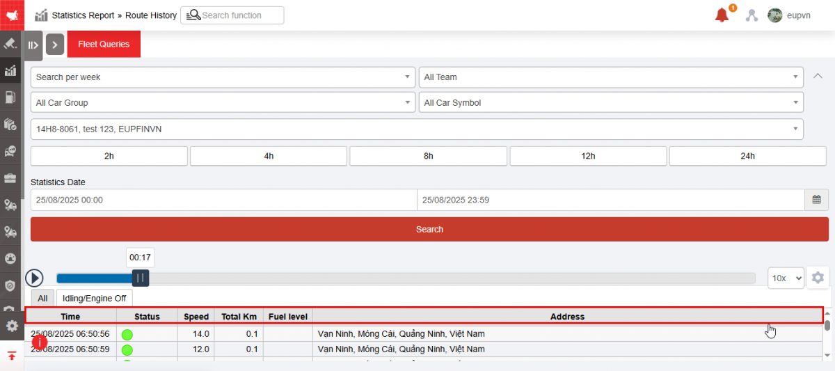
Travel information:
-
Time: Updated every 30 seconds
-
Status: Status of the vehicle
-
Speed: Average speed of the car in 30s
-
Total Km
-
Fuel level
-
Address: The address of the vehicle's destination at the time of updating the data to the system
-